Eretria Harbour Project
Genesis of the Project
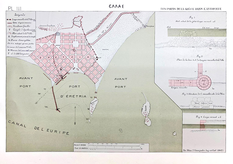
The ancient port of Eretria has always attracted the interest of researchers. At the beginning of the last century, engineer Athanasios S. Georgiadis, in his study of Greek ports in antiquity, documented and commented on the visible coastal remains of that time. He recorded several sections of the fortification wall, a tower, and the large mole enclosing the western anchorage. His schematic drawings are the only archaeological records of the ruins before the port’s redevelopment in the 1960s, which significantly altered them. These same ruins were photographed and studied by Greek archaeologist Evangelos Kampouroglou in 1989 during his geological survey of the seabed. The evolution of Eretria’s coastline was further clarified in 2016 through an interdisciplinary publication led by Mathieu Ghilardi (CNRS). These studies provide an environmental framework for understanding the maritime structures in their context. To build on this, precise archaeological investigation is necessary.
Eretria Harbour Project (2024-2026)
The Eretria Harbour Project, born from a collaboration between the Ephorate of Underwater Antiquities (EUA), the Swiss School of Archaeology in Greece (ESAG), and the Foundation Octopus, aims to document and preserve these threatened remains. Initiated in 2024, this three-year project, directed by Eleni Banou and Sylvian Fachard, focuses on systematically cleaning and mapping the submerged and coastal structures while documenting the seabed with bathymetric surveys. The field team comprises members of the EUA, the Octopus Foundation, and students from Swiss universities supervised by the ESAG. In addition to site research, the project provides students with training in underwater archaeological techniques.
A Vast Area
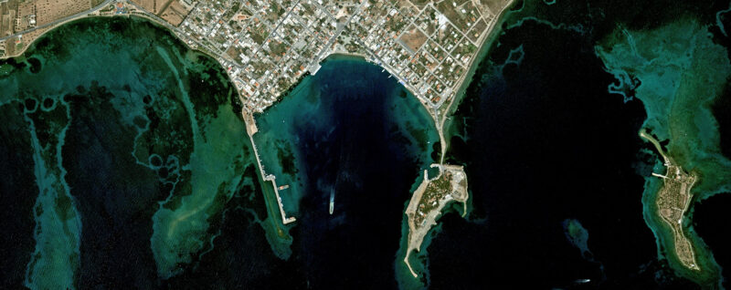
The ancient city of Eretria took full advantage of its access to the sea to trade and establish colonies across the Mediterranean. Its location on the northern coast of the Euboean Gulf allowed it to control the passage between Attica and northern Greece. To the north and south, the mountain ranges of Euboea and Attica made navigation through the Euripus Strait highly practical. Sheltered from eastern currents by its coastline and the Pezonisi peninsula, the Eretrians closed off the western anchorage by constructing a mole exceeding 600 meters. The ancient basin closely corresponds to the modern port, with a surface area exceeding 70 hectares, matching that of the ancient city. To explore and document this vast area, aerial and underwater surveys have been conducted with technical support from the Octopus Foundation. The first campaign in 2024 focused on the western half of the port, less affected by modern construction except for the partially concreted mole. The next campaign, scheduled for summer 2025, will cover the eastern part of the basin, which remains largely unexplored.
Monumental Remains
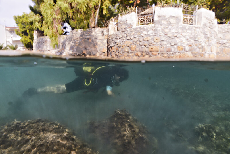
The cleaning efforts have revealed the extension of the maritime fortification of the city. The tower known as “Georgiadis,” now attached to a seaside villa, and the submerged sections have been mapped topographically. The dimensions of the blocks observed match those used in Eretria’s Hellenistic fortifications. An archaeological assessment has also documented the degradation of a section located on the beach, previously drawn in 1984. Some of the missing blocks have been reused in modern nearby pontoons.
The southern area is closed off by a dyke approximately 130 meters long, installed at depths between 2.5 and 3 meters. Cleaning part of this structure revealed the presence of architectural blocks embedded in the rubble that makes up most of the construction. To the west, outside the fortified zone, the ancient mole is visible for over 300 meters, with depths varying between 2.5 and 3.5 meters. An oval-shaped, angled structure is distinguishable at its southern end, though its function remains unclear. Today, most of the mole lies submerged, but it would have been exposed at the surface during antiquity.
For further information


