Eretria-Amarynthos Survey Project (EASP 2021-2025)
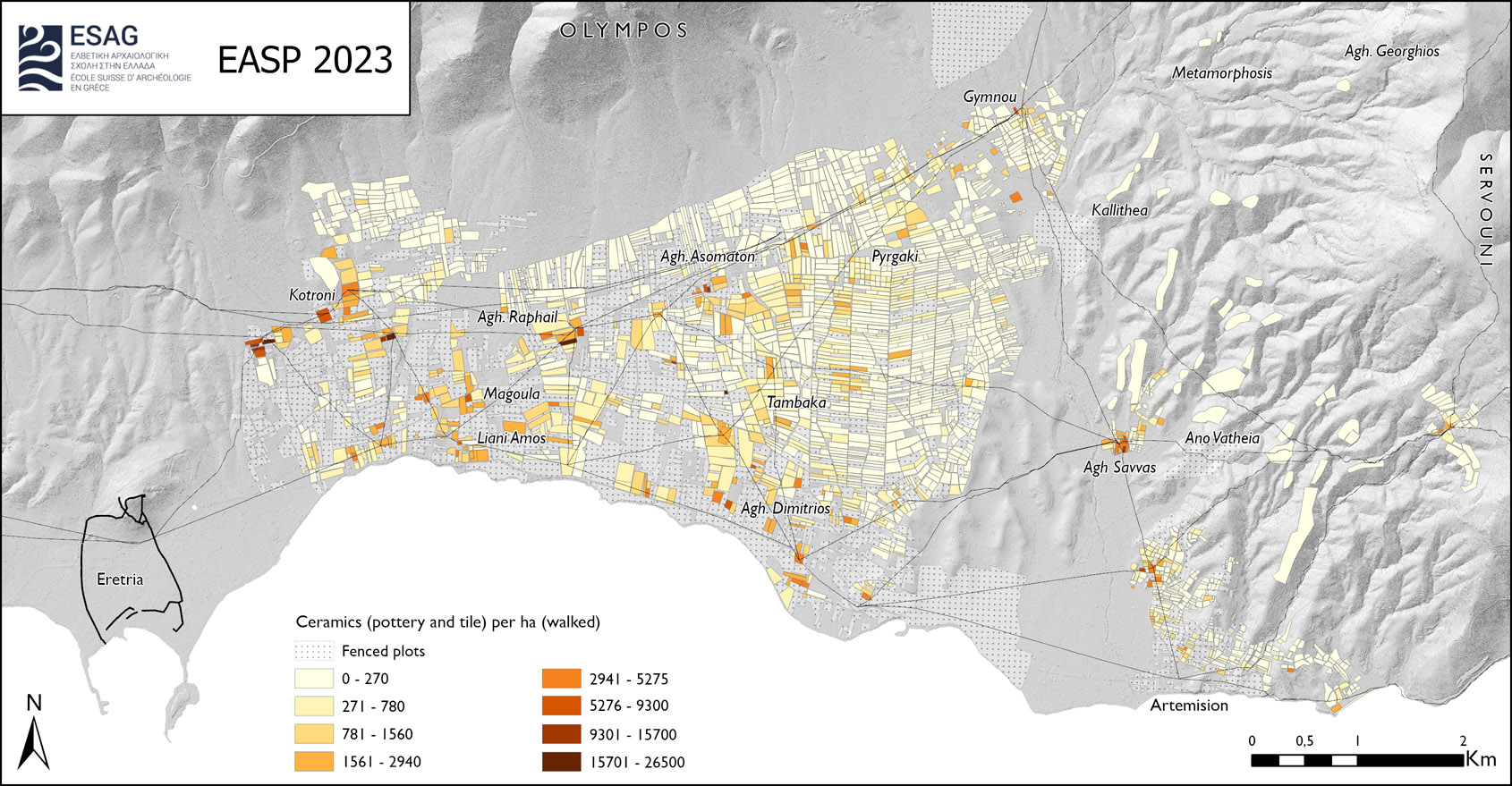
The exploration of the sanctuary of Artemis is linked to a survey project of the region between Eretria and Amarynthos (EASP), with the aim of investigating the relationship between the sanctuary and the surrounding demes, the land use, the communication network and the rural economy of the region. By the end of the third campaign, which took place in 2023, 21km2 had been systematically and methodically surveyed, revealing 189 structures from all periods. In terms of its geographical coverage, the variety of approaches adopted and the technical resources invested, the EASP is already establishing itself as one of the most ambitious survey projects of the last decade in Greece.
Further reading
S. Fachard et al., The Artemision at Amarynthos: The 2023 Season. AntK 67(2024):95–109.
S. Fachard et al., The Artemision at Amarynthos: The 2022 Season. AntK 66(2023):93–100.
S. Fachard et al., The Artemision at Amarynthos: The 2021 Season. AntK 65(2022):128–142.
Methods
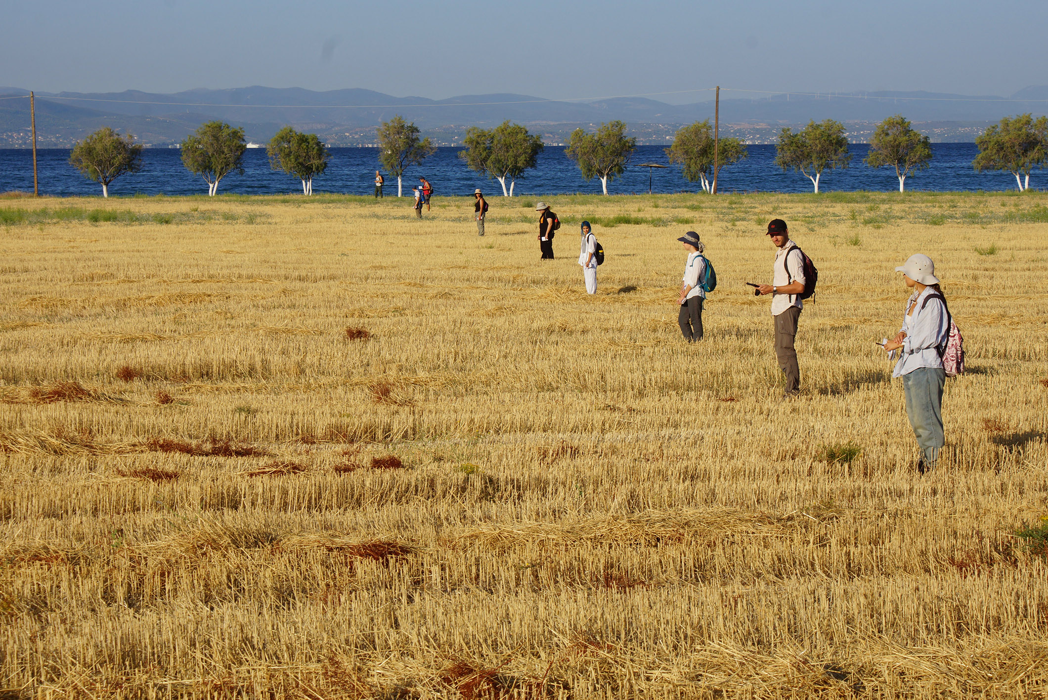
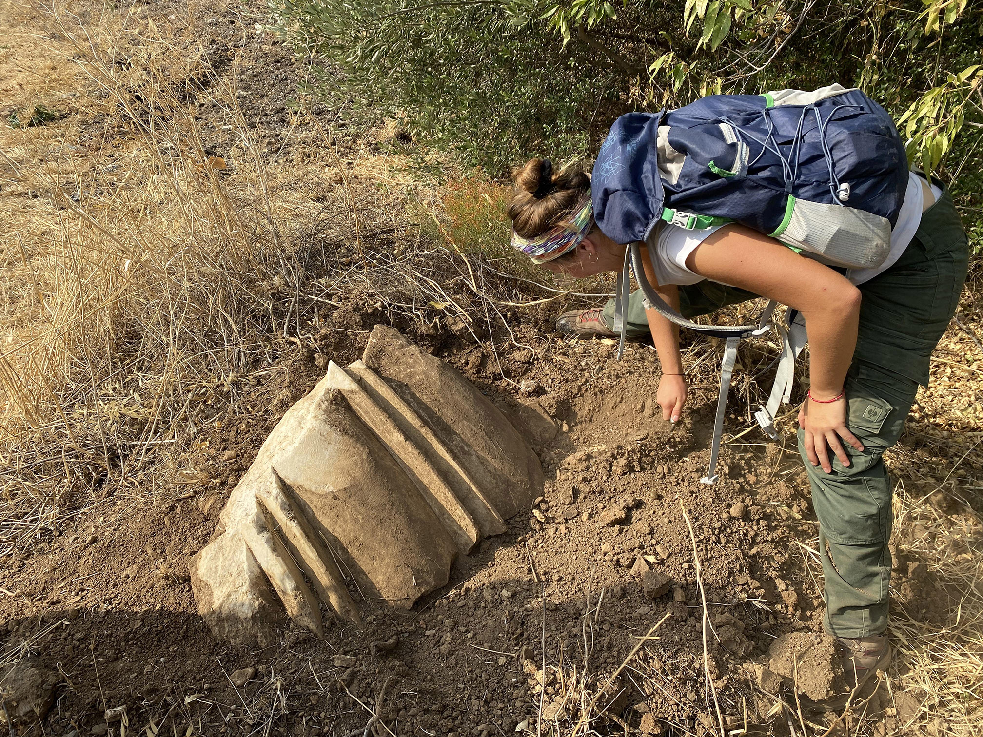
The method used is what is known as ‘intensive’ archaeological survey, in which prospection units are surveyed by walking in a line at 10m intervals and systematically tallying up all the pottery sherds, tile fragments and lithic tools observed on the surface. The counts are then entered into a Geographic Information System (GIS), which can be used to display the density of ceramics and tiles, and to accurately map the ancient remains visible on the surface. The pedestrian survey is complemented by remote sensing based on new LiDAR coverage. This method, commonly known as remote sensing, allows archaeologists to explore areas that are less accessible to teams in an ‘extensive’ manner, targeting areas likely to yield remains.
Study area
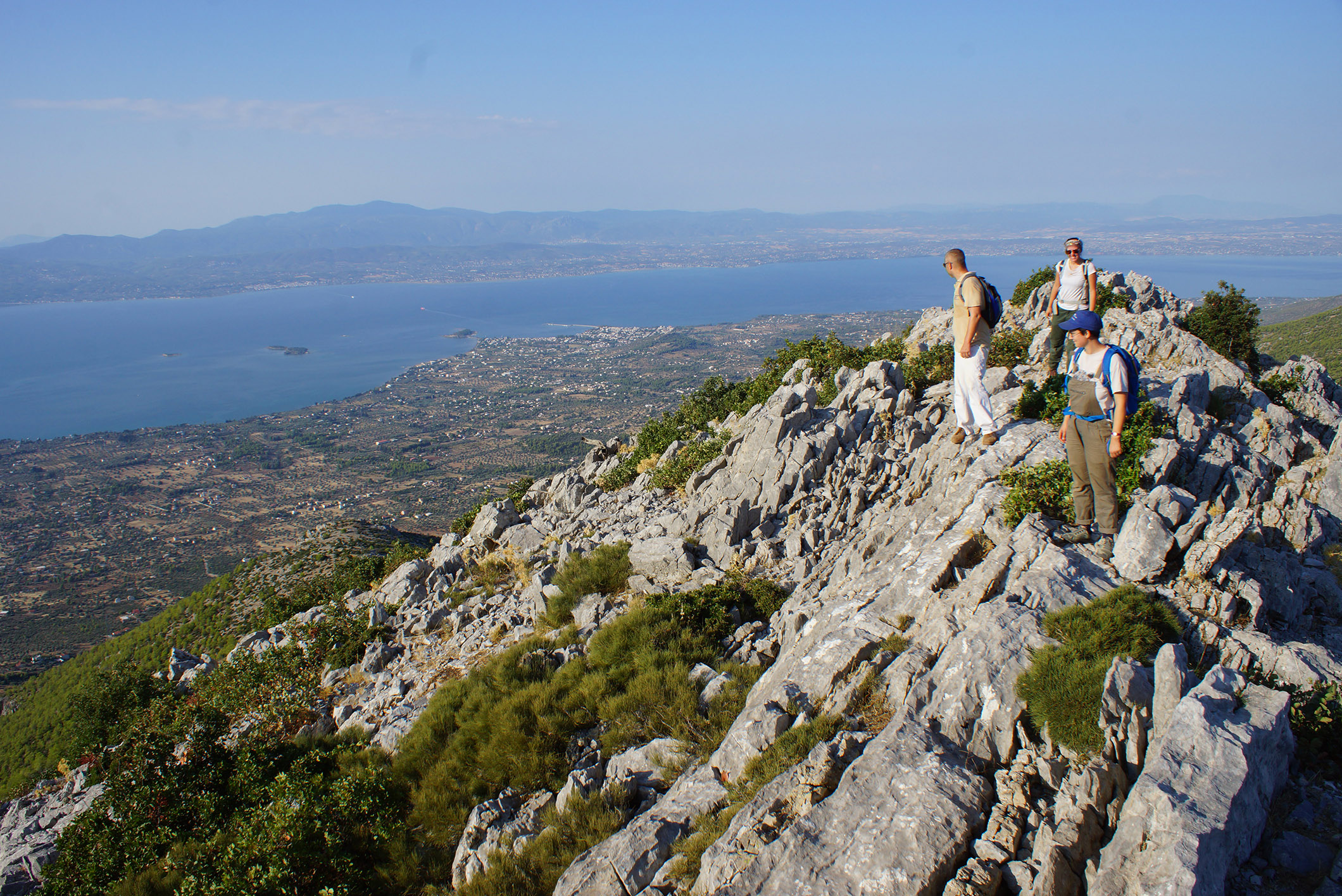
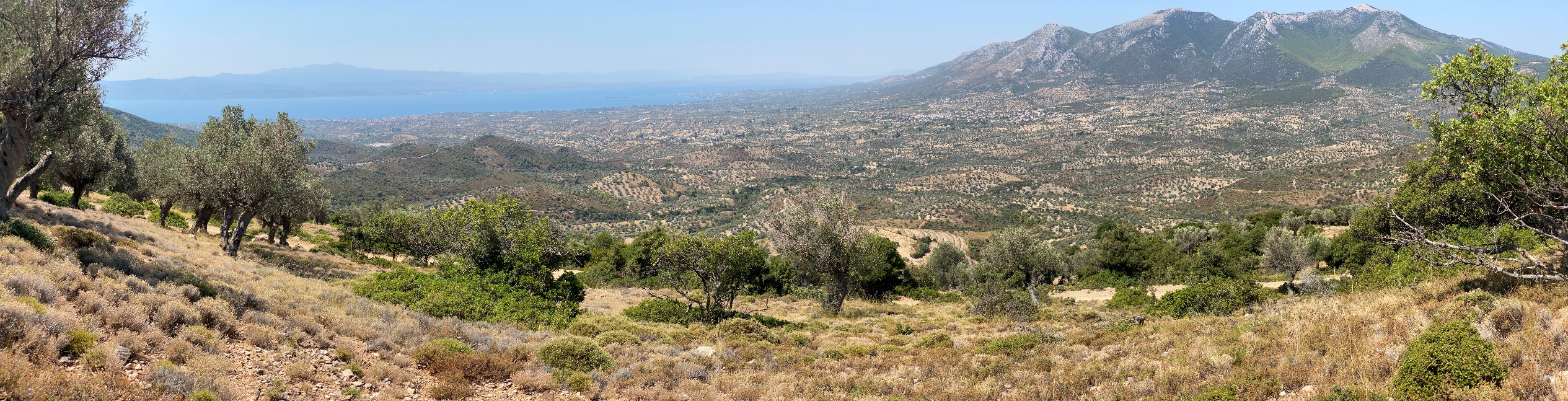
The study area includes the vast stretch of coastline between Eretria and Amarynthos, the Sarandapotamos watershed and the foothills of the Voudochi and Servouni mountains. In 2021, the teams concentrated on the eastern part of Eretria, between Magoula and the modern town of Amarynthos. The aim of the 2022 campaign was to explore two micro-regions of the plain separated by the Sarandapotamos delta: to the west, the area between Aghios Dimitrios and the modern village of Amarynthos; to the east, the area around Artemision and the western slopes of Mount Servouni. Finally, the 2023 mission covered the upper part of the Eretrian plain, connecting with the valley of the Sarandapotamos river and continuing prospecting on the slopes of Servouni.
A first overview of human occupation
In addition to the already known sites of Eretria, Magoula and Amarynthos, the survey uncovered several sites from the Late Neolithic and Early Bronze Age. However, no Middle Bronze Age, Late Bronze Age or even Iron Age sherds were found, suggesting that there was relatively little, if any, occupation in the area during these periods.
Near the coast, occupation increased from the 6th century BC, with the development of four new sites demonstrating the dynamism of the region in the Archaic period. The presence of several rural settlements outside the sites of Eretria and Amarynthos also confirms the testimony of Herodotus, who mentions some of these demes in his account of the Persian siege of Eretria.
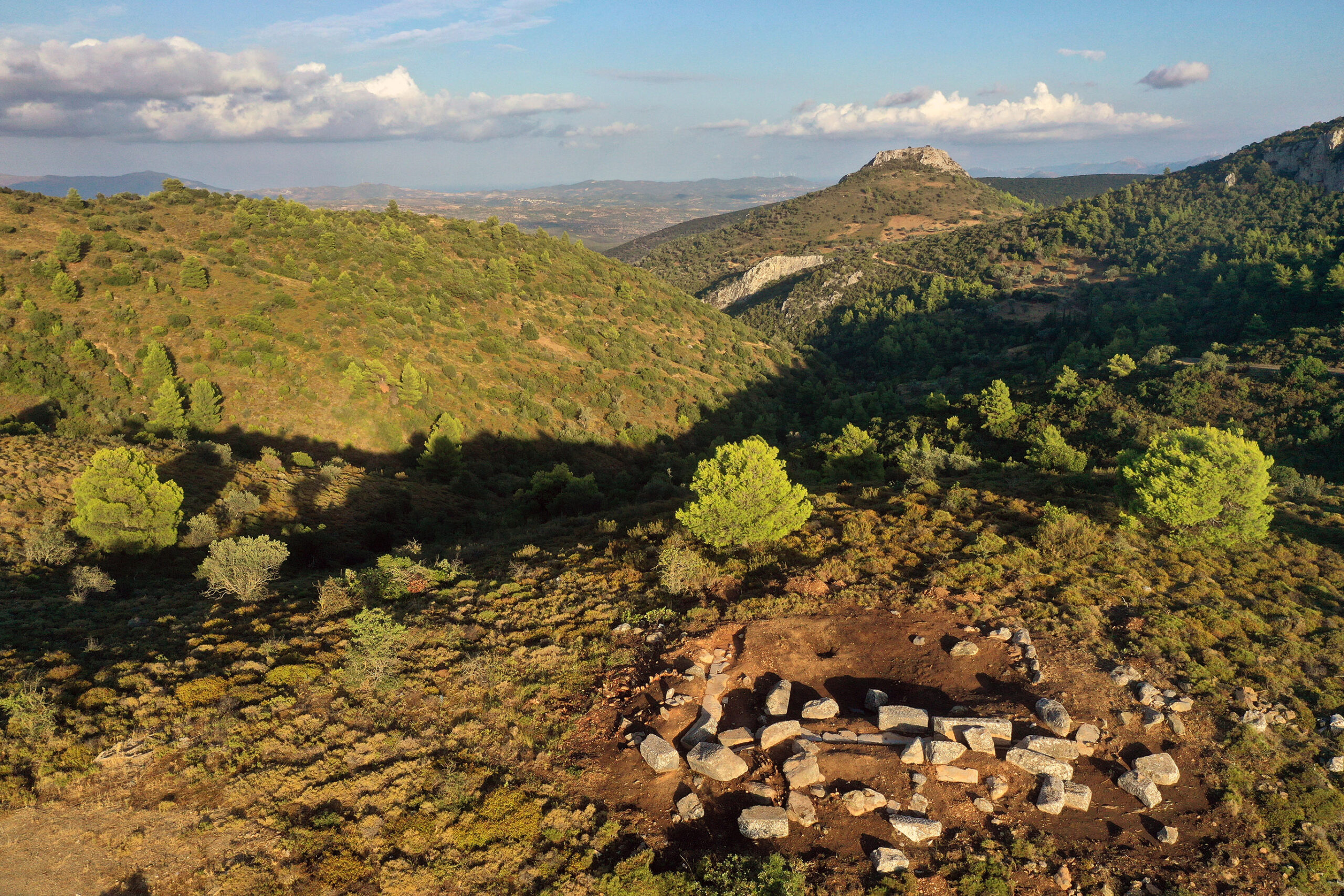
The occupation of the coastal strip intensified during the Classical period. Rural settlement expanded, with the creation of secondary dwellings and the establishment of agricultural settlements. At the same time, there was a densification of grouped settlements around several scattered and more diffuse nuclei. These are primary settlements that we have tentatively interpreted as centres of demes, such as Amarynthos, possibly represented by a high density less than a kilometre to the north of the sanctuary. On the other hand, the upper part of the plain, characterised by steeper terrain, has very clearly delineated areas of high ceramic density separated by areas of low density, making it easier to delineate sectors of activity and ancient settlements. Moreover, this region seems to have been less densely populated than the coastal strip, which does not mean that it was not used for agricultural purposes, as evidenced by the discovery of around ten isolated farmsteads dating from the Classical and Hellenistic periods.
In the Hellenistic period there was a marked decline in the occupation of the plain. If we can identify the main centres of settlement in the Classical period, they decrease considerably in size, suggesting a significant decline in rural settlement. This trend was reversed in Roman times, when there was a slight increase in rural occupation, concentrated around the main demes that had been inhabited in previous centuries.
In Late Antiquity, settlement concentrated around Kotroni and Magoula, and a site developed to the west of the modern town of Amarynthos. While the Byzantine presence was very weak in the area between Eretria and Amarynthos, there was a high density of Byzantine occupation throughout the eastern part of the plain, particularly on the slopes of the Servouni, probably under the impetus of the monastery of Aghios Nikolaos.
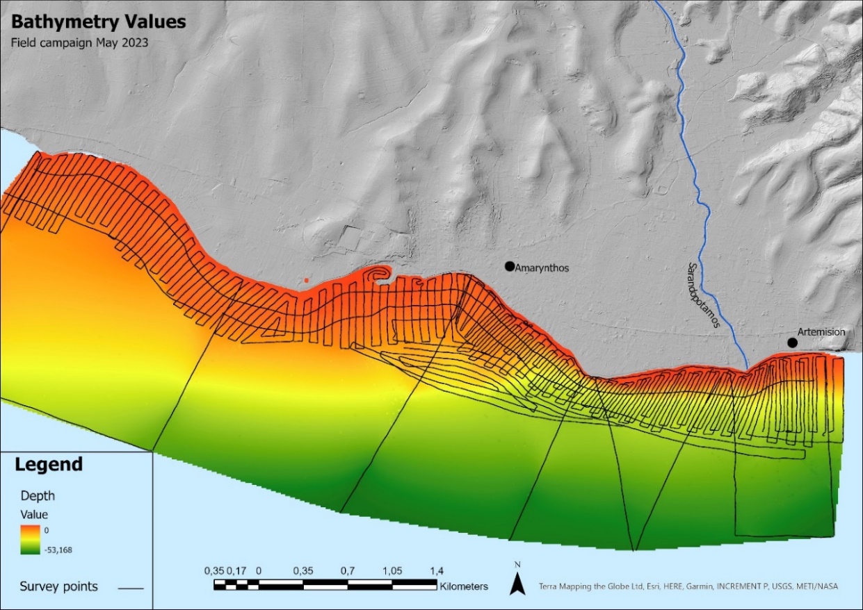
Geomorphology
In ancient times, the landscape in which the sanctuary developed was completely different from the one we see today. In fact, if we go back to 4000 BC, we find a shallow bay, gradually filled in by the sediments of the nearby Sarantopotamos river. The topography of the area was then characterised by the wandering of the river and the presence of marshes. Understanding how the site has evolved over the centuries means reconstructing this ancient environment and measuring its impact on human occupation. Following core drilling campaigns carried out around the sanctuary by Matthieu Ghilardi (CNRS), interest shifted to the watershed at the mouth of which Amarynthos is located. Tibor Talas, a PhD student in geomorphology at the University of Lausanne, is using a wide range of techniques to study the hydrology of this basin, its transformation and its interaction with anthropogenic phenomena: laser mapping of the relief (LiDAR), coring of the river’s palaeo-deltas, dating of sediments by luminescence (OSL), underwater surveys with echosounders, modelling of the evolution of the terrain and reconstruction of the ancient vegetation cover. The contribution of the geosciences has enabled us to gain a better understanding of the dynamics of erosion and alluviation, to relate them to the ceramic densities observed on the surface, and to identify the areas most suitable for housing and agriculture in the long term.