Fieldwork 2016
Excavations in Gymnasium of Eretria (Euboea)
The second excavation season in the Gymnasium (27/06−29/07), directed by Guy Ackermann (University of Lausanne) and Rocco Tettamanti (ΕΑΣ), aimed at extending the excavation in the eastern part of the building. The entrance of the building was uncovered. It appears to have been later blocked off when the internal layout of the edifice was modified. The room U is a late addition since it was not erected before the middle of the 2nd c. BC. It opened on the eastern side of the central courtyard through three columns and two pilasters. Bases found inside the room along the wall belonged to a bench.
Exploratory trenches were also conducted to gather evidence for its construction date. Finds in the western part of the palestra indicate a construction around 330–320 BC. It remained in use until the end of the 1st c. AD if not later, whereas the eastern part seems to have been abandoned a century earlier.
The unexpected discovery of three bronze statue fragments in a well is exceptional in the long history of excavations at Eretria. The two forearms, as well as a section of clothing were brought to light together with numerous bones belonging to several human individuals and animals. The well was filled sometime in the 3rd c. AD.
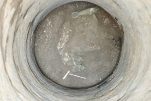
Forearm and part of clothing belonging to a bronze statue discovered in a well in the Gymnasium
Excavations in the Artemision of Amarynthos (Euboea)
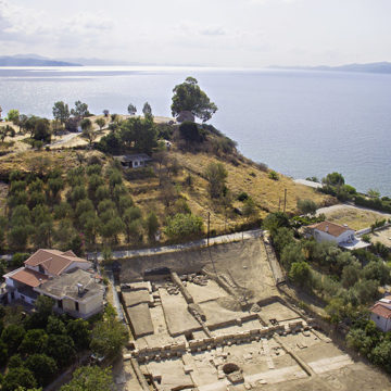
The Amarynthos project aims at locating the sanctuary of Artemis Amarysia, the Eretrians’ main extra-urban place of worship. The latest excavations at the foot of the Bronze Age hill site of Paleoekklisies uncovered several monumental buildings from the Early Iron Age to the Hellenistic period which attest to the location of the Artemision. The excavations are directed by Tobias Krapf and Thierry Theurillat (ΕΑΣ) in collaboration with the Ephorate of Antiquities of Euboea. The 2016 season (01/08−09/09) witnessed significant developments. The extension of the Hellenistic stoa to the north was brought to light; it forms a right angle to the north-west to produce an L-shaped winged stoa or portico enclosing a courtyard, where the core of the sanctuary is believed to be situated, according to Denis Knoepfler (Collège de France), scientific director of the project.
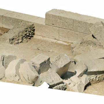
The stoa is partially founded on a roadway from the Classical period, which seals an earlier roadway of the 7th c. BC with the same orientation. Excavations behind the stoa uncovered a new monumental building dated to the Late Hellenistic period. It was partially built into the hillslope with massive sandstone ashlar blocks.
Survey in Mazi (Attica)
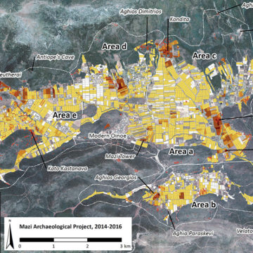
The Mazi Archaeological Project (MAP) is a diachronic regional survey of the borderland between Attica, Boeotia and the Megarid, a strategic region located on the ancient road connecting Eleusis to Thebes. The project is a collaboration with the Ephorate of Antiquities of west Attica, Piraeus and Islands, and co-directed by Sylvian Fachard (University of Geneva), Alex Knodell (Carelton College), and Popi Papangeli (Ephorate of west Attica, Piraeus and Islands). The project aims to address long-term questions of human occupation in the Attic-Boeotian borderlands.
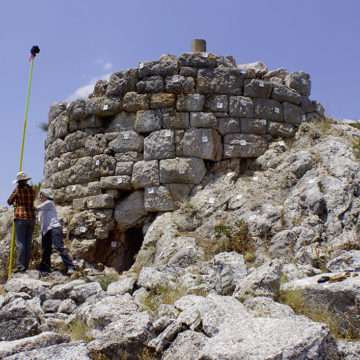
The 2016 season saw the completion of the intensive survey in the Mazi plain. The project also included site clearings (at the Eleutherai fortress and the Prehistoric site of Kato Kastanava), feature documentation using photogrammetry and DGPS mapping, as well as a geophysical survey at Ancient Oinoe. After three fieldwork seasons, 12 km2 were surveyed, 593 archaeological features and 100’000 finds were discovered and documented in a GIS.
Underwater excavation at Kiladha (Argolid)
The Bay of Kiladha project aims at exploring the archaeological remains in a small cove in the South Argolid. The project, directed by Despina Koutsoumba (Ephorate of Underwater Antiquities) and Julien Beck (University of Geneva), is a collaboration between the Ephorate of Underwater Antiquities and the Swiss School of Archaeology in Greece, under the supervision of their respective directors, Aggeliki Simosi and Karl Reber.
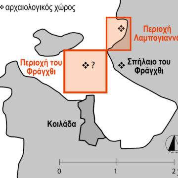
The main objective in 2016 was to clarify the plan and the chronology of the Bronze Age offshore site (Early Helladic II) discovered to the north of Kiladha Bay, at Lambayanna.
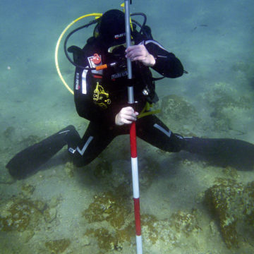
Three different methods were implemented: a topographical survey of the archaeological remains, a geophysical survey (magnetic and electrical resistivity), and underwater excavations. The results of the topographical and geophysical surveys show that the settlement is not limited to the remains currently visible underwater but extends inland, buried beneath the beach. Limited underwater excavations were conducted. Finds from an exploratory trench are connected to an earlier settlement (Early Helladic I) and attest to a longer occupation of the site than previously thought.
